Studying Roseau Cane to Solve State’s Coastal Land Loss
March 16, 2023
Louisiana’s alarming land loss makes LSU the ideal place for Xuelian “Shelley“ Meng to conduct her research and educate the state’s future land loss fighters. The LSU Department of Geography & Anthropology associate professor joined LSU in 2012.

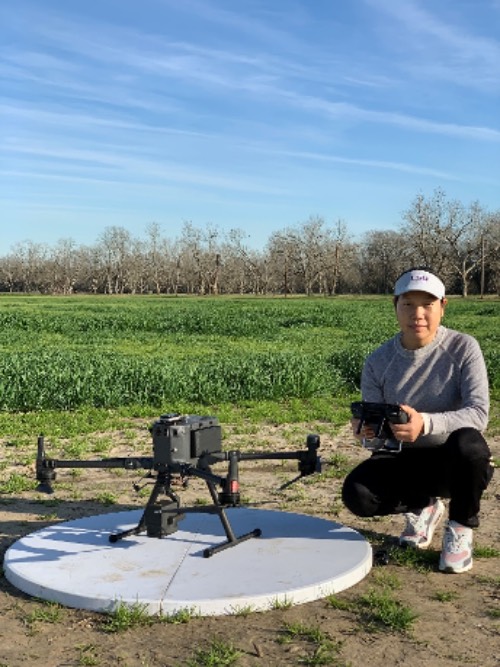
Xuelian “Shelley“ Meng studies coastal land loss through Rouseau cane die-off.
– Photo: Xuelian “Shelley“ Meng
“The importance of the Mississippi River Delta and Gulf of Mexico, the alarming land loss concern and various disturbances to the coastal wetlands make Louisiana an ideal location for remote sensing and Geographic Information System (GIS) research,” Meng said.
Meng’s current research focuses on Roseau cane die-off, a wetland grass, along the Louisiana coast including the lower Mississippi River Delta, Atchafalaya Basin, Vermilion Bay and Rockefeller Wildlife Refuge. This research is part of large multidisciplinary projects led by LSU AgCenter researcher Rodrigo Diaz funded by the USDA Animal and Plant Health Inspection Service, or APHIS.
“Unfortunately, Louisiana is suffering an alarming rate of land loss. Roseau cane is one of the dominant wetland species in coastal Louisiana because of its high tolerance to salinity and inundation. However, in recent years, severe scale infection has added one more cause to large scale Roseau cane die-off and further increases land loss. Understanding Roseau cane die-off severity, spatial distribution and its dynamics with other wetland habitats is critical for wetland preservation and coastal residences,” Meng said.
Using drones, remote sensing technologies including drones and satellite images, Meng and her team analyze, quantify and map the distribution of Roseau cane. They assess the overall wetland die-off, Roseau cane habitat distribution and conduct multi-seasonal drone monitoring of wetland habitats and how it is impacted by and recovers from wetland disturbances. They also analyzed the impact of Hurricane Ida in 2021.
Meng said over 40 percent of the nation’s wetlands can be found in Louisiana, but that may not always be the case with the increase in coastal land loss. Therefore, her research is essential for wetland and coastal preservation.
“This research helps to quantitatively assess the wetland and Roseau cane die-off and map their spatial distribution. Multi-seasonal drone monitoring further allows fine-scale analysis of wetland habitat dynamics and their resilience to disturbances such as freeze and hurricane. The results are helpful to understand Roseau cane habitat and wetland preservation and useful for decision making with government and environmental agencies,” Meng said.
Like the government and environmental agencies, Meng hopes her students also learn how to solve the wetland crisis.
“The students in my GIS and Remote Sensing courses learn the fundamental concepts and techniques in the field, gain extensive hands-on experience with software exercises and learn how to apply the technology to solve real-world problems. I hope my students will be confident in handling their future work with what they learned in my classes,” Meng said.


