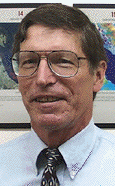
 Anthony J. Lewis
Professor Emeritus
Education
Ph.D. University of Kansas, 1971.
Selected Publications
Lewis, B.A., J.H. Wrenn, A.J. Lewis, J.J. Alford and D. Alford, 2003. Middle Wisconsinan and recent wet site mummified wood, humus, peat, and pollen, Santa Rosa Island, Florida, Review of Paleobotany and Palynology, Vol. 126, pp.243-266.
Lewis, A.J. (Associate Editor and English Editor), 2001. Radar Remote Sensing Applications in China (Edited by Guo Huadong). Taylor & Francis, Inc. New York, NY, 244p.
Lewis, A. J., 2000. Satellite Tour of Louisiana (Interpretations and Descriptions of Physical and Cultural Geography of 37 Landsat images of Louisiana. In: Braud, D.H., 2000. Louisiana GIS CD, Louisiana Oil Spill Coordinators Office (LOSCO), Office of the Governor and Louisiana State University, Baton Rouge, LA.
Lewis, A.J., S.J. McNeill, and A.D.W. Fowler, 1999. “Interpretation of Almaz-1A SAR Imagery of the Wairarapa, New Zealand.” Geocarto International. 14(3):77-87.
Henderson, F.M. and A.J. Lewis, co-eds. 1998. Principles and Applications of Imaging Radar: Manual of Remote Sensing, 3rd Edition. Bethesda, MD: American Society of Photogrammetric Engineering and Remote Sensing, 866 pages. Note: Also author or co-author to four chapters in the above.
Courses Taught
Physical Geography
Air Photo Interpretation of Cultural Features
Air Photo Interpretation of Physical Features
Environmental Remote Sensing
Advanced Remote Sensing Seminar